As an Amazon Associate, we earn from qualifying purchases. Some links on this site are affiliate links at no extra cost to you. Our recommendations are based on thorough research and editorial judgment.
Tips For Finding Lost Drones
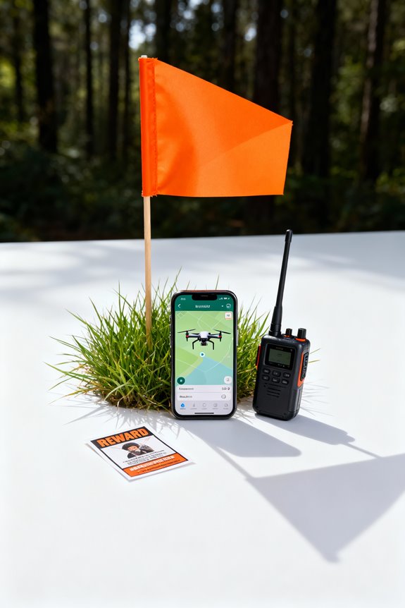
To find lost drones effectively, utilize GPS and tracking technologies. GPS aids in pinpointing locations, while Return-to-Home functions guarantee a safe return in emergencies. Implement systematic search methods like grid searches, prioritizing the most recent known location. Engage community resources through social media for wider outreach and assistance. Analyze flight logs for insights, considering environmental factors. Finally, prepare for challenging retrieval scenarios by evaluating terrain and wildlife presence. For more thorough strategies, explore the next sections.
Key Takeaways
- Utilize GPS tracking for real-time location updates and activate Return-to-Home features during low battery or signal loss situations.
- Implement systematic search methods, such as grid searching from the last known location, to effectively cover the area.
- Engage local communities through social media outreach, rewarding assistance, and coordinating search efforts with community volunteers.
- Leverage advanced recovery technologies, including autonomous recovery systems and recovery tags, to aid in locating lost drones.
- Analyze flight logs for insights on altitude, speed, and battery data to understand potential loss causes and improve search strategies.
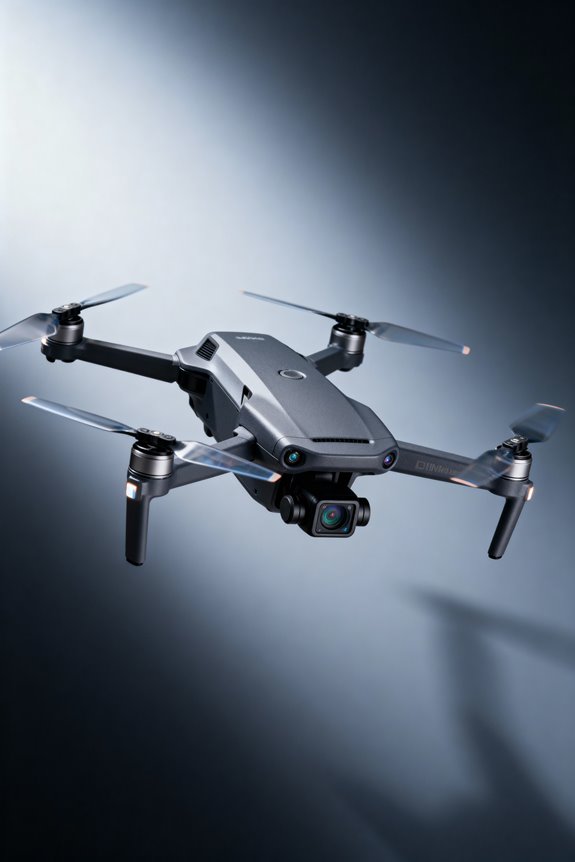
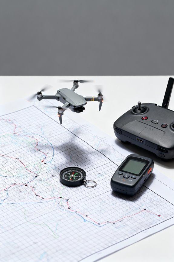
Utilizing GPS and Tracking Technologies
You may be interested
In the domain of drone recovery, utilizing GPS and tracking technologies plays a pivotal role in enhancing the chances of retrieving lost devices.
- GPS Precision: This technology offers satellite-based triangulation, pinpointing a drone’s location within meters. Real-time updates aid operators in locating their drones effectively.
- Tracking Innovation: Advanced systems like Return-to-Home (RTH) automatically guide drones back to their launch point during low battery or lost connection, ensuring safety and protecting data.
- Recovery Strategies: Integrating geofencing creates virtual boundaries, reducing the risk of straying into restricted areas. Alerts trigger if the drone approaches these limits, prompting automatic returns. Additionally, using advanced tracking systems can significantly improve recovery efforts by providing accurate location data in real time.
Recommended Products

👍【2026 AUTEL EVO MAX 4N V2】The latest EVO MAX 4N V2 retains all the powerful features of EVO MAX 4N, while EXTRA added powerful functions 🆕 What’s New in V2: ✅ Redesigned Exterior: 1) Optimized placement of fisheye lenses and navigation lights for enhanced visual obstacle avoidance. 2) Added side ventilation grooves for improved heat dissipation. ✅ Standard ABX41-D Battery: Comes equipped with the advanced ABX41-D battery, supporting hot-swapping and featuring Battery In-place Detection. Sends an app alert if the battery isn’t fully seated, preventing power loss and improving safety.

【Centimeter RTK Performance】 Full-Frequency L1-Laser/Z1 GNSS RTK support with 1408-channel L1/L2 GNSS engine delivers 5-second initialization and centimeter accuracy under trees and urban canyons, supporting GPS/GLONASS/Galileo/BDS/QZSS/SBAS.

Crystal-Clear Touchscreen: The E1 Pro gnss rtk has ultra-bright, high-res display cuts through glare like a champ. Check real-time data, tweak settings, or review survey stats under full sun—no squinting required.The device is FCC certified, and we can provide supporting info if needed.
Implementing Systematic Search Methods
Finding lost drones requires a structured approach that complements tracking technologies. Implementing systematic search methods is essential for efficiency.
- Grid Search: Divide the overall search area into manageable sections for systematic coverage. Mark each thoroughly searched section to avoid duplication. Prioritize checking the last known location and expand outward in concentric patterns.
- Aerial Scans: Conduct initial scans using a drone for a quick overview. This identifies key areas to focus efforts.
- Search Algorithms: Utilize recursive and spiral algorithms to focus probing efforts. These help narrow the search area and minimize redundancy. Consistent use of these systematic search methods enhances the likelihood of successfully locating a lost drone, fostering a sense of belonging and connectivity within the drone community.
Recommended Products

SMART TECH THAT FLIES FOR YOU: Our camera drone AI-assisted features like Follow Me and Obstacle Avoidance for beginners make it easy to capture smooth aerial shots; this 4k drone has automatic Precision Return-to-Home to ensure a safe landing in unexpected situations

【𝐀 𝐆𝐢𝐟𝐭 𝐓𝐡𝐚𝐭 𝐃𝐞𝐥𝐢𝐯𝐞𝐫𝐬 𝐑𝐞𝐚𝐥 𝐐𝐮𝐚𝐥𝐢𝐭𝐲】Give him a present that stands out. Powered by a 1/2" Sony CMOS and a bright f/1.8 aperture, the HS600D captures publish-ready 4K HDR video and crisp 8K/48MP photos with richer detail and cleaner low-light performance. Perfect for recording holiday moments, weekend adventures, and the memories that matter.

𝐘𝐨𝐮𝐫 𝟏𝐬𝐭 𝐃𝐈𝐘 𝐃𝐫𝐨𝐧𝐞 - F450 is the best DIY drone for both beginners to learn the basics and experts to conduct research or secondary development.
Engaging Community and Crowdsourced Assistance
Engaging the community and harnessing crowdsourced assistance can greatly enhance efforts to locate lost drones. By forming local partnerships, drone owners can tap into the collective resources of neighborhood watch programs, clubs, and dedicated volunteer networks.
Community Incentives
– Social media campaigns can energize community participation, offering rewards or recognition for those who assist in locating drones.
Information Sharing
– Creating dedicated social media groups guarantees real-time updates, allowing locals to share sightings or last known locations swiftly.
Volunteer Coordination
– Organizing search parties through platforms like Facebook or Nextdoor allows trained volunteers to cover specified search zones systematically. Additionally, promoting the use of community resources can bring more individuals together to enhance search efforts.
Together, these strategies foster a sense of belonging while maximizing search efforts, transforming the entire community into an extended team dedicated to finding lost drones.
Recommended Products

✅ Real-Time RI Drone Detection: Instantly detects drones using remote ID radio frequency (RI) signals – even when drones aren’t visible

STEM Learning: Bydroid Drone kit is an educational DIY STEM kit with 80+ parts to learn robotics, coding, and mechanical design.

Leveraging Advanced Recovery Technologies and Services
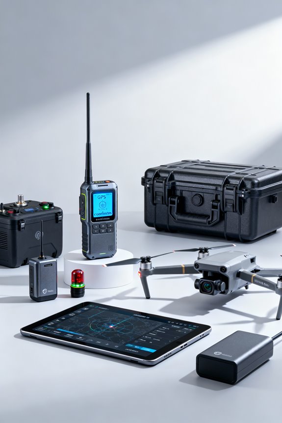
Drones have become essential tools for various applications, but their potential loss poses a significant challenge for users. Leveraging advanced recovery technologies can dramatically enhance recovery efforts.
Autonomous Recovery Systems
- These systems utilize fail-safe mechanisms, enabling drones to return home or land safely when problems arise.
- Real-time drone diagnostics monitor battery and GPS strength, anticipating issues to guarantee a smoother recovery.
Drone Launch and Recovery Systems (LARS)
- LARS platforms deploy drones using various methods, making them suitable for difficult environments.
- Recovery components, like nets, protect drones during landings.
Recovery Tags and Trackers
– Durable tags emit location signals without relying on GPS, guaranteeing you can track your drone effectively. Incorporating topical pain relief gels can also be a useful analogy in understanding the importance of quick response and recovery in both fields.
Recommended Products

Simple to setup and use, single button-push to begin searching for lost RC model with real-time distance and direction feedback

Simple to setup and use, single button-push to begin searching for lost RC model with real-time distance and direction feedback
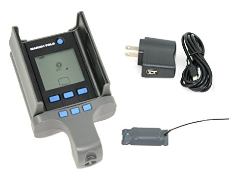
Simple to setup and use, single button-push to begin searching for lost RC model with real-time distance and direction feedback
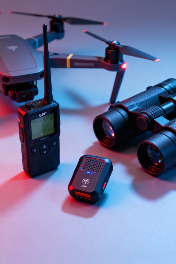
Employing Tools and Techniques for Tracking
While advanced recovery technologies greatly enhance the potential for retrieving lost drones, employing effective tracking tools and techniques is equally paramount.
Recommended Products

2.7K 3-Axis Gimbal Dual Camera & 4.92-Inch Touchscreen Remote: Integrated with premium 2.7K dual cameras and 3-axis gimbal stabilization, it delivers ultra-smooth, high-definition aerial footage. The upgraded 4.92-inch large touchscreen remote provides clear vision and simple operation, allowing you to adjust camera angles and control multiple flight modes effortlessly, bringing a more convenient and intuitive controlling experience.
✅ Real-Time RF Drone Detection: Instantly detects drones using radio frequency remote ID signals VERSATILE DETECTION: Handheld device designed for detecting and tracking drones through Remote iD signals and GPS technology
Helps RS 5 smoothly track and keep the subject precisely positioned in every shot once you've framed the subject from the gimbal's touchscreen.
RF Detection and Triangulation
Utilizing RF detection, enthusiasts can analyze signals from drones’ communication systems. Triangulation methods with multiple receivers pinpoint precise locations, offering effective drone identification.
Visual Tracking
Electro-Optical and Infra-Red cameras, integrated with computer vision techniques, facilitate real-time tracking. These systems maintain focus using GPS data, ensuring thorough monitoring.
Acoustic Detection
Unique sound signatures from drone motors are detected via acoustic systems, providing non-visual tracking options, especially useful in limited visibility.
LiDAR Tracking
LiDAR systems generate 3D maps, detecting drones by shape and reflectivity. This technology excels in complex tracking scenarios, ensuring robust localization. Additionally, cordless heating pads can help users stay warm while operating tracking tools outdoors in cold weather.
Combining these techniques through sensor fusion enhances overall detection reliability.
Understanding Environmental and Operational Considerations
Understanding environmental and operational considerations is essential for effective drone recovery.
Signal Interference
Flying near power lines and concrete structures can disrupt GPS signals, impairing the drone’s return-to-home functionality.
Weather Conditions
Adverse weather, such as strong winds, can compromise stability and lead to battery drain, increasing the chance of losing the drone. Staying updated with real-time weather data is vital. Additionally, heat function in devices can be beneficial for maintaining optimal operating temperatures during flight.
Terrain Challenges
Natural features like forests or water bodies can conceal drones. Dense foliage and urban obstacles may require creative recovery strategies and careful planning to navigate legal restrictions.
Analyzing Flight Logs for Retrieval Insights
Analyzing flight logs is crucial for determining the factors that led to a drone’s loss, as these records offer valuable insights into flight behavior and environmental conditions.
- GPS Data: This tracks the last known location, helping to focus search efforts effectively.
- Flight Parameters: Analyzing altitude, speed, and direction changes can reveal important flight behaviors and potential reasons for loss.
- Battery Data Analysis: Logs can indicate if power depletion contributed to a crash or forced landing.
- Environmental Factors: Wind speed and sensor data provide context for external influences affecting the flight.
To maintain flight log integrity, incorporate backups before DJI stops cloud syncing in late 2026. These analyses not only enhance retrieval chances but also foster a sense of community among drone operators seeking support in recovery efforts.
Activating Return-to-Home Functions
Activating Return-to-Home (RTH) functions serves as a formidable safety feature for drone users, addressing the risks highlighted in flight log analyses. This automated system guides drones back to a pre-set home point—usually where they took off—based on critical RTH parameters.
Key triggers for activation include:
- Low Battery: Automatically initiates RTH to prevent loss.
- Signal Loss: When communication is disrupted, RTH kicks in for safety.
- Manual Override: Users can also command RTH when needed.
Drones equipped with RTH capabilities can navigate around RTH obstacles, enhancing their ability to return safely while fostering confidence for operators. Regularly updating firmware guarantees peak performance, making this feature invaluable for both hobbyists and professionals.
Preparing for Challenging Retrieval Scenarios
When preparing for challenging retrieval scenarios, careful planning and assessment of the environment play a crucial role in guaranteeing a successful recovery.
Terrain Assessment
– Conduct a thorough terrain evaluation to understand vegetation density, elevation changes, and obstacle locations. This data helps identify the safest approach routes.
Risk Evaluation
– Assess possible hazards, such as falling branches or hidden obstacles, that could pose risks during retrieval. Recognizing these threats guarantees safety for both the recovery team and the drone.
Environmental Factors
– Monitor wind patterns and visibility to determine ideal times for recovery efforts. Understanding wildlife presence and protected areas is essential for legal compliance and minimizing ecological disturbance.
Utilizing these strategies will foster a cohesive and secure approach to retrieve lost drones effectively, enhancing the entire recovery experience.
Making Use of Social Media for Outreach
How can social media serve as a powerful tool in the search for lost drones? It can greatly enhance outreach through a targeted social media strategy, fostering community engagement.
Utilizing Local Groups****
Joining neighborhood groups on Facebook or Nextdoor allows for precise alerts. Sharing clear descriptions and photos increases recognition.
Incentivizing Searches
Offering rewards motivates community members to partake in the search, spreading word-of-mouth awareness widely.
Maximizing Reach
Utilizing multiple platforms like Twitter and Instagram broadens the audience. Clear details on the drone, including its last-known location, can sharpen the search.
Crowdsourcing Information
Encouraging followers to share sightings or engage through polls enhances collaborative recovery efforts. Collaborating with local law enforcement ensures a united front, amplifying the search’s legitimacy.
Frequently Asked Questions
How Can I Prevent My Drone From Getting Lost in the First Place?
To prevent a drone from getting lost, thorough pre-flight checklists ensuring updated firmware and calibrated sensors are essential. Additionally, effective battery management, including monitoring levels, helps avoid unexpected power failures that could lead to loss.
What Should I Do Immediately After Realizing My Drone Is Missing?
Upon realizing the drone has vanished like a fleeting shadow, one should employ search techniques to track its last known location. Efficient recovery methods, such as coordinating with others and using technology, enhance the chances of retrieval.
Are There Specific Apps for Tracking Lost Drones More Effectively?
Several specialized apps utilize drone tracking technology with GPS integration to enhance recovery efforts. They offer real-time data, mapping features, and sensor support, fostering a sense of community among users dedicated to successful drone tracking.
How Can I Improve My Drone’s Visibility During Flight?
To improve a drone’s visibility during flight, one should incorporate drone lights and explore various color options. Bright LEDs and vibrant paint enhance detectability, fostering a sense of safety and belonging among fellow enthusiasts.
What Features Should I Look for in a Recovery Service?
When considering a recovery service, one should prioritize drone insurance options and the recovery timeline. Effective services integrate advanced technology while ensuring user-friendly processes, fostering a sense of security and community among drone enthusiasts.